


Who We Are
Guide of the Year
Documents
Charity & SR
Latest Posts
Questions & Answers

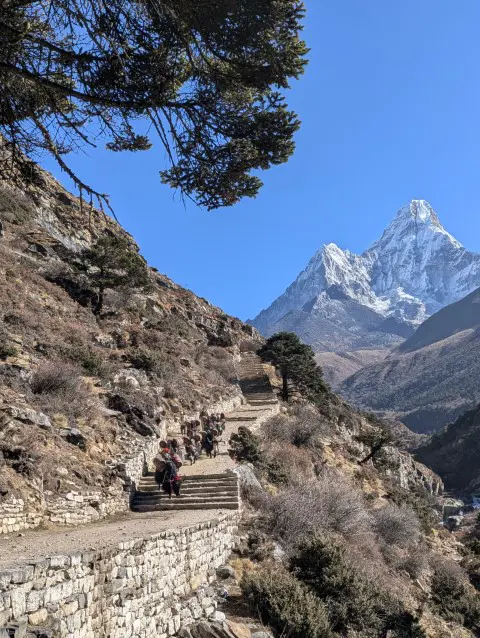
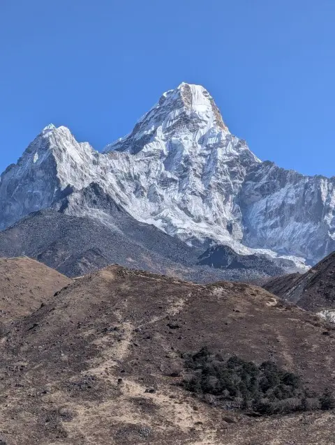
Ama Dablam is a 6,812 meter (22,349 ft) mountain in the Khumbu region of Nepal and a part of the Himalayas, in the Maha Langur range. Its name means ‘Mother’s Necklace’ in Sherpa and is a reference to its iconic shape, the extended ridges resemble a mother’s arms, while the hanging glacier mimics a pendant (dablam).
It is also known as Amai Dablang and called the ‘Matterhorn of the Himalaya’, comparing it to the iconic mountain in the Alps.
Located near Everest Base Camp, Ama Dablam is a technically challenging climb, featuring steep ice, rock, and mixed terrain above Camp II. Despite its difficulty, it attracts experienced mountaineers due to its striking beauty and proximity to the Everest trekking route.
First summited in 1961 by a team including Barry Bishop and Sherpa climbers, Ama Dablam now requires a few permits to climb. The best time to climb it is during October-November (post-monsoon).
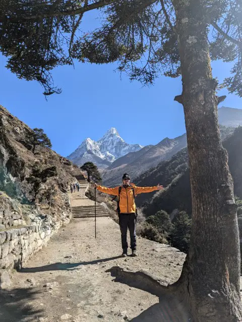
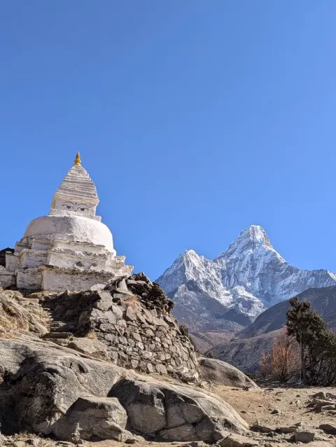
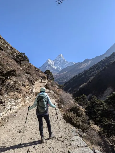
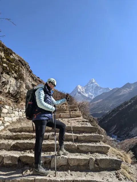
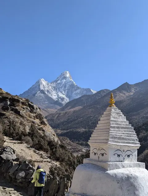
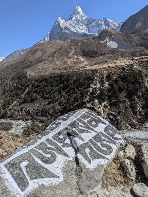
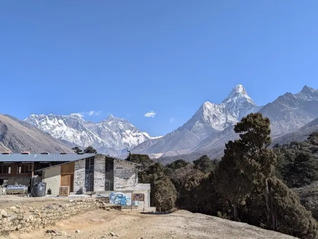
For many trekkers, Ama Dablam is a highlight of the Everest region, especially because of its panoramic views from Pangboche and Tengboche. It is considered one of the most beautiful mountains in the world.
In November 2020, Sheikh Mohammed bin Abdullah Al Thani of the Qatar royal family also visited the mountain spoke of its beauty (Nepali Times, 2000). Its profile is also one of the most photographed peaks in Nepal.
Ama Dablam: Key Information at a Glance
| Category | Details |
| Elevation | 6,812m (22,349ft) |
| Location | Khumbu region, Nepal (Maha Langur Himal range) |
| Coordinates | 27°51'42"N, 86°51'50"E |
| Name Meaning | ‘Mother’s Necklace’ (Sherpa) → ridges = arms, hanging glacier = pendant (dablam) |
| Nicknames | ‘Matterhorn of the Himalaya’, Amai Dablang |
| First Ascent | 1961 (Barry Bishop, Mike Gill, and Sherpa team) |
| Climbing Season | Best: October to November (autumn); Alternative: March to May (spring) |
| Technical Difficulty | Advanced (steep ice/rock/mixed terrain, UIAA Grade III-IV, 50–60° slopes) |
| Key Route | Southwest Ridge – Base Camp (4,600m) → Camp I (5,700m) → Camp II (6,000m, Yellow Tower) → Camp III (6,300m) → Summit (6,814m) |
| Major Hazards | Avalanches, icefall from Dablam glacier, AMS, extreme cold (–30°C near summit) |
| Permits Required |
|
| Lodging | Basic tea houses (Namche, Pangboche, Deboche): shared rooms, dal bhat meals, no heating, limited electricity/Wi-Fi |
| Notable Visitor | Sheikh Mohammed bin Abdullah Al Thani (Qatar royal family, Nov 2020) |
| Weather (Best Season) |
|
| Trekking Highlights | Panoramic views from Pangboche/Tengboche; among world’s most photographed peaks |
The standard route to Ama Dablam follows the Southwest Ridge, which is a technically demanding climb that requires solid alpine and mixed climbing experience. The route begins at Base Camp (4,600m), where climbers acclimatize with hikes to higher elevations.
From there, the ascent to Camp I (5,700m) involves a steep scramble over loose moraine and snow slopes of 40-50° inclination, often with fixed ropes for safety.
The most challenging section comes between Camp I and Camp II (6,000m), where climbers must navigate exposed rock climbing (UIAA Grade III-IV) and traverse the famous Yellow Tower, a steep rock step secured with fixed lines. Above Camp II, the route to Camp III (6,300m) consists of steep ice and snow slopes (50-60°) with a high risk of avalanches, requiring careful movement and timing.
The summit push (6,812m) is the most demanding part, with a steep 60° plus snow climb beneath the unstable Dablam hanging glacier, where falling ice is a constant hazard.
Difficulties
Key difficulties while climbing Ama Dablam include the technical terrain, which demands advanced rope skills and crampon technique, as well as the rapid altitude gain, both of which increase the risk of Acute Mountain Sickness (AMS). Weather conditions are unpredictable, with storms, high winds, and extreme cold near the summit.
Objective hazards like avalanches and icefall from the Dablam glacier add to the challenge. Logistics are also demanding, with limited space at high camps. This means climbers need to carry essential gear or rely on Sherpa support.
Most expeditions are guided, with Sherpa teams fixing ropes on critical sections like the Yellow Tower. The summit day is long and grueling, typically taking 10-14 hours from Camp II or III. Climbers must be prepared for extreme cold, exhaustion, and high-altitude effects.
Before attempting Ama Dablam, climbers should have prior experience on 5,000m+ peaks and strong technical alpine climbing skills. Solo climbs are strongly discouraged due to the mountain's objective dangers.
Proper acclimatization, physical fitness and carefulness are crucial for a safe and successful climb.
 Lodging and Facilities Near Ama Dablam
Trekkers and climbers approaching Ama Dablam will find basic tea houses along the route, primarily in villages like Namche Bazaar, Pangboche and Deboche. These provide simple accommodation and meals, though comfort levels decrease at higher elevations.
Rooms are typically shared, with twin beds and thin mattresses. Blankets are provided, but bringing a sleeping bag is recommended. Heating is uncommon, and most tea houses rely on insulated dining areas with stoves in the evening.
Food consists of Nepali staples like dal bhat (rice, lentils, vegetables), as well as basic Western options (pasta, potatoes, eggs). Meat becomes scarcer at higher altitudes due to limited refrigeration. Bottled water is available for purchase, but using purification tablets or filters is a more sustainable option.
Facilities are minimal. Shared squat toilets are standard, with most tea houses offering no hot showers. Some lodges in Namche offer paid hot showers (solar or gas-heated). Electricity is available for charging devices, but outlets may be limited, and power cuts are common.
Wi-Fi is accessible in Namche (for a fee) but unreliable beyond. Costs increase with altitude.
| Season | Months | Avg High (°C) | Avg Low (°C) | Overall Avg (°C) |
| Winter | December to February | -10 to -9 | -18 to -17 | ~ -13.5 |
| Spring | March to May | -7 to -2 | -15 to -10 | ~ -9 |
| Summer | June to August | ~0 to 2 | -8 to -5 | ~ -3 |
| Autumn | September to November | -2 to -6 | -10 to -14 | ~ -8 |
Note: (Meteoblue, 2025)
Ama Dablam, standing tall at 6,812 meters (22349 ft), experiences extreme alpine weather throughout the year. Winters (December to February) are bitterly cold, with average high temperatures hovering around -10°C and lows dipping below -18°C. Although the skies remain mostly clear, the frigid conditions and high winds make this season unsuitable for trekking or climbing.
Spring (March to May) brings a gradual warming trend, with average highs ranging from -7°C to -2°C. This season offers the most stable weather, clear skies, and excellent visibility, making it the best time to attempt Ama Dablam expeditions. It’s also the preferred season for photography and high-altitude trekking.
Summer (June to August), while warmer (with highs around 0°C to 2°C), marks the onset of the monsoon. Increased precipitation, cloud cover, and the risk of landslides or avalanches make this period less favorable for visits.
Autumn (September to November) is another prime season. With post-monsoon clarity, mild temperatures (highs between -6°C and -2°C), and stable weather patterns, it's considered the second-best window for climbing and trekking Ama Dablam.
For the most rewarding experience, plan your visit during spring (March to May) or autumn (late September to November) when the weather is clearest and the mountain is at its most majestic.
Meteoblue. (2025). Weather Archive Ama Dablam. Meteoblue. https://www.meteoblue.com/en/weather/historyclimate/weatherarchive/ama-dablam_nepal_6941998?fcstlength=1y&year=2025&month=6
Nepali Times. (2000, November 18). What is it about Ama Dablam? Nepali Times. https://nepalitimes.com/banner/what-is-it-about-ama-dablam
Trek Me Nepal Archives
Check out recent travel trends and news by Trek me Nepal


More Reasons Why Travellers Trust Us


 : Location, Altitude, Climate, Tengboche Monastery, Mani Rimbu, Accomodation & Scenic Highlights")


Bipin Thapa
Operation Manager | Official Trekking Guide
Anyone who has trekked before knows trekking requires planning, and a deep understanding of the land. That is where Bipin Thapa Magar comes in. As the Operations Manager at Trek Me Nepal, he is the ba... Read More