


Who We Are
Guide of the Year
Documents
Charity & SR
Latest Posts
Questions & Answers

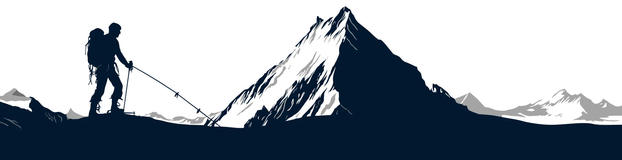
Nestled along the banks of the Budhi Gandaki River in Nepal’s Gorkha district, Machha Khola (translated as “Fish River” in Nepali) serves as the first major overnight stop for trekkers embarking on the Manaslu Circuit.
Situated at an elevation of approximately 900 meters, this scenic riverside village marks the transition from the subtropical foothills of Soti Khola to the more remote Himalayan trails of the upper Manaslu region.
Its location and tranquil atmosphere make it a critical gateway for acclimatization and cultural immersion before venturing deeper into the mountains.
| Category | Details |
| Location | Gorkha District, Nepal, along the Budhi Gandaki River. Elevation: ~900m. |
| Role in Trek | First major overnight stop on the Manaslu Circuit, serving as an acclimatization hub. |
| Trek from Soti Khola | 14 km (6-7 hours); gradual ascent (700m to 900m). |
| Key Features |
|
| Transport from Kathmandu | - Public Bus: 10-12 hours to Soti Khola + 2-3 hours to Machha Khola. - Private Jeep: 7-9 hours. |
| Best Time to Visit | Spring (Mar-May): Rhododendrons bloom, mild temps. Autumn (Sep-Nov): Clear skies, festivals. Avoid monsoon (Jun-Aug) and winter (Dec-Feb) for easier conditions. |
| Accommodation | Basic teahouses with twin-share rooms, shared bathrooms, solar-powered charging (~NPR 100-200/hour). |
| Food Options | - Dal Bhat (unlimited refills), thukpa, Gurung bread. - Limited vegan/gluten-free options. |
| Permits Required | Manaslu Conservation Area Permit (MCAP); TIMS card if applicable. |
Machha Khola is a resting point and a foundational segment of the Manaslu trekking route. After departing Soti Khola (~700m), trekkers cover a 6-7 hour stretch, crossing suspension bridges, following river trails, and navigating gradual ascents, before arriving here.
The village’s elevation gain (~200m from Soti Khola) is deliberately moderate, aiding acclimatization while offering a preview of the terrain ahead. The Budhi Gandaki River flows through lush valleys, flanked by terraced farmlands and traditional settlements.
As the trail’s first major halt, Machha Khola has essential amenities like teahouses and basic lodges, ensuring trekkers can restock energy before continuing toward Jagat and beyond.
Its position also signifies a shift in landscape: the dense subtropical forests of the lower trail gradually give way to alpine vegetation, with occasional sightings of native wildlife like langur monkeys and Himalayan birds.
Beyond its logistical importance, Machha Khola introduces trekkers to the cultural and environmental diversity of the Manaslu region.
The village is home to Gurung and Magar communities, whose hospitality and traditional lifestyles offer an authentic glimpse into rural Nepalese life. Stone houses with slate roofs dot the landscape, and the rhythmic sounds of the river and farm activities create a serene backdrop.
The upper Manaslu trails, accessed via Machha Khola, grow progressively steeper and more rugged, leading to high-altitude villages like Samdo and Larkya La Pass. This village, therefore, acts as a gentle prelude to the challenges ahead, combining practicality (last reliable amenities before Jagat) with a quiet, unhurried charm.
Its suspension bridges and riverside trails also foreshadow the dramatic gorges and glacial valleys that define the later stages of the circuit.
Machha Khola is accessible via a 7 to 12-hour overland journey from Kathmandu, depending on road conditions and the mode of transportation. The most common route follows the Kathmandu-Dhading-Trishuli-Arughat-Soti Khola-Machha Khola route.
The highway from Kathmandu to Dhading (Prithvi Highway) is paved, but beyond Trishuli, the road narrows into a rough, unpaved track prone to delays during monsoon (June–August) due to landslides.
The final segment from Arughat to Soti Khola is particularly rugged, with river crossings and steep sections requiring 4WD vehicles.
The trek from Soti Khola to Machha Khola spans approximately 14 km (6–7 hours), following the Budhi Gandaki River valley. This section is critical for acclimatization, with a gradual elevation gain from 700m (Soti Khola) to 900m (Machha Khola).
For more details on Permits required to trek through the Manaslu Region, check it out here!
For more details, check out our Essential Guide to Manaslu Circuit Trek.
| Season | Months | Temperature (Day/Night) | Trail Conditions |
| Spring | Mar-May | 15-25°C / 5-15°C | Dry, good visibility |
| Autumn | Sep-Nov | 10-20°C / 0-10°C | Firm, dry trails |
| Monsoon | Jun-Aug | 18-28°C (humid) | Muddy, landslides, leeches |
| Winter | Dec-Feb | 5-15°C / -5-5°C | Possible snow above 3,000m |
The optimal periods for trekking to Machha Khola are during spring (March to May) and autumn (September to November). These seasons offer stable weather conditions, clear mountain views, and comfortable temperatures for trekking.
Spring (March-May) Characteristics
Autumn (September-November) Characteristics
Monsoon Season (June-August)
Winter Season (December-February)
Climate-Specific Preparation Tips
Local Climate Patterns
For more information on Weather in the Manaslu region, check out our blog here.
Machha Khola offers basic but functional accommodation options catering primarily to trekkers on the Manaslu Circuit. The village has several family-run tea houses and lodges, all following the standard Nepali trekking lodge model.
Room Types and Facilities
The food menu follows standard Nepali trekking fare, with some local variations. All meals are prepared fresh upon ordering.
Standard Menu Items
Local Specialties
Dietary Notes
Supplies and Extras
All lodges operate on similar standards, with minor variations in cleanliness and food quality. The limited competition keeps prices and services fairly uniform across the village.
For cost details, check out our blog here.
The trek from Soti Khola to Machha Khola follows the Budhi Gandaki River through a varied landscape that introduces trekkers to the Manaslu region's geography.
The trail maintains close proximity to the river, crossing several suspension bridges that offer views of the water carving through both wide gravel beds and narrow gorges. Rocky sections require careful navigation, particularly after rainfall when surfaces become slippery.
Agricultural terraces dominate the valley slopes, showcasing intricate farming systems that change with the seasons. During monsoon months, rice paddies fill the terraces, while maize and millet appear in drier periods.
Small irrigation channels divert river water across these cultivated areas, demonstrating traditional water management techniques.
The vegetation transitions noticeably along the route. Starting in subtropical forests between 700-900m, the trail passes through stands of chir pine and sal trees with bamboo groves.
As elevation increases, temperate species like rhododendron begin appearing, along with moss-covered rocks and trees. This zone marks the first appearance of Himalayan flora, including wild orchids and primulas.
Geological features include exposed slate and shale formations along river cuts, evidence of frequent landslides (particularly after the monsoon), and the natural hot springs at Tatopani, which serve as a preview of features further along the trail toward Jagat.
Machha Khola presents the first substantial cultural experience on the Manaslu Circuit, with its linear development along the trail and river. Traditional stone houses with slate roofs dominate the architecture, though some newer concrete structures are appearing.
The village center clusters around the main trail junction, where most lodges are located.
Daily life unfolds visibly along the trails and in the village. Women can be seen processing grains using traditional dhiki and janto tools, while men transport goods in doko baskets.
The local school's morning and afternoon sessions bring children into the streets, offering glimpses of mountain community life. Small Buddhist gompas mark village edges, with prayer flags decorating river crossings and high points.
Photography opportunities benefit from morning light between 6-8 AM when sunlight enters the valley. Worthwhile subjects include the suspension bridges with river backdrops, terraced fields during planting or harvest, and traditional architectural details like carved windows.
Wildlife observations might include langur monkeys, various bird species, and, with luck, yellow-throated martens or Himalayan black bears.
Here's our blog on Major Festivals, Culture and Tradition in Manaslu Region for a more detailed read.
The next segment of the Manaslu Circuit trek covers the 22 km (6-7 hours) journey from Machha Khola (900m) to Jagat (1,340m). This section introduces more dramatic Himalayan terrain while maintaining a manageable elevation gain of 440m.
Key Stages of the Route
The path alternates between riverside walks and cliffside trails carved into stone. Narrow gorges and waterfalls become more frequent as the valley constricts. Several landslide areas require attention during/after the monsoon season.
Machha Khola serves as more than just a stopover on the Manaslu Circuit as it represents the gateway to Nepal’s remote Himalayan wilderness.
Situated at 900m along the Budhi Gandaki River, the village offers trekkers their first taste of authentic mountain culture, with Gurung and Magar hospitality, traditional stone houses, and terraced farmlands.
The trek from Soti Khola to Machha Khola (6-7 hours) eases hikers into the journey with gradual elevation gain, suspension bridge crossings, and lush subtropical scenery.
As the first major overnight stop, it provides essential teahouse accommodations while setting the stage for the more challenging trails ahead toward Jagat and beyond.
Key highlights include:
We offer three approaches to experiencing Machha Khola and beyond. Our classic 13-day Manaslu Circuit includes a proper rest stop here to adjust to trail conditions.
The 16-day extended version allows more time to explore the Gurung and Magar communities in the area.
For those wanting the complete experience, our 21-day Tsum Valley combination trek uses Machha Khola as the launching point toward higher elevations.
Our team can also create customized trips, adjusting pace, side excursions, or adding cultural activities. We handle all permits and logistics so you can focus on the stunning scenery and meaningful interactions along this legendary trekking route.
Trek Me Nepal Archives
Check out recent travel trends and news by Trek me Nepal


More Reasons Why Travellers Trust Us


 : Location, Altitude, Climate, Tengboche Monastery, Mani Rimbu, Accomodation & Scenic Highlights")


Bipin Thapa
Operation Manager | Official Trekking Guide
Anyone who has trekked before knows trekking requires planning, and a deep understanding of the land. That is where Bipin Thapa Magar comes in. As the Operations Manager at Trek Me Nepal, he is the ba... Read More